Solar
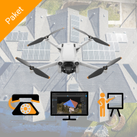
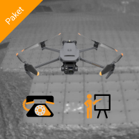
Roof measurement of detached houses? View the Solar 1000 square metre Cloud package now.
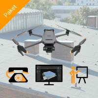
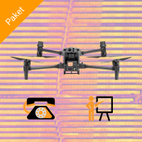
Roof measurement of hall, commercial and industrial roofs? View the Solar 50 ha Survey Cloud package now.
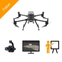
Roof measurement and thermographic inspection in one? View the Solar 50 ha Survey + Inspection Cloud package now.
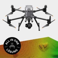
Terrain model for solar parks? View the Solar 200 ha Survey + Inspection Desktop package now.
Already have a drone? View the Airclip Cloud service for roof surveys now.
- SKU:
- AC27013
Highlights
- simple operation including measuring tools
- 3D model in the web viewer
- Import into common planning software
- from as little as €50 per project
Suitable for
- PV planners
- PV installers
- Solar engineers
- Scaffolders
- SKU:
- AC27165
Highlights
- hull insurance included
- no drone driving licence required
- ready-to-fly drone packages
Suitable for
- Photovoltaic companies
- Roofers
- Surveying of single and multi-family houses up to 1000 m²
- quick, cost-effective entry into commercial drones
- SKU:
- AC27166
Highlights
- fast, precise, automated
- RTK technology
- including drone training
- ready-to-fly drone packages
Suitable for
- Photovoltaic companies
- Surveying of houses, halls and open spaces up to 50 ha
- quick, cost-effective introduction to commercial drones
- SKU:
- AC27047
Highlights
- drone-based PV inspection up to 50 ha, simple fault detection
- high-resolution thermography drone, quick to learn
- includes training and drone licence
Suitable for
- Photovoltaic companies
- Service providers for thermographic inspection of PV systems
- Beginners and professionals in the thermographic inspection of PV systems
- SKU:
- AC27050
- SKU:
- AC27196
Highlights
- data acquisition accurate to the centimetre
- RTK technology
- Ready-to-fly package
Suitable for
- Photovoltaic companies
- Surveying of houses, halls and open spaces up to 200 ha
- optical inspection of PV systems with up to 200 ha
- SKU:
- AC27198
Simply inspect PV systems from the air - both visually and thermographically - up to an area of 400 hectares.
Which drone is right for me?
The world of drones is large and confusing. That's why we have developed ready-made solutions for you. The core is always a drone, which is of course available in many different qualities. But what exactly is important? Our colleague Ricardo explains this in the video below using the example of roof measurements. A brief summary of the features:
- Camera resolution (12 MP, 20 MP and more)
- Flight planning app (available or not available - particularly important for large areas over 1000 square metres)
- RTK support (especially important for large areas over 1000 square metres)
- Features for companies such as airspace monitoring via ADS-B
How does a roof survey with drones work?
The process is always the same:
- Take photos systematically,
- Convert photos into a 3D model and
- into planning software.
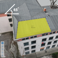
The intelligence is in the software (step 2.). using a process known as photogrammetry, systematically taken photos can be translated into realistic 3D models. This has one particular advantage: you don't need any reference on the roof. But how does this work? The trick is to record the GPS coordinates and the orientation angle of the camera and use them to calculate a three-dimensional model of the object being photographed - just like humans with their two eyes.
Is there a barrier to entry?
First things first: anyone can take drone measurements! As always, however, there are of course a few pitfalls that need to be explained to you - and that's exactly what we/Airclip do! ;) Surveying with drones is anything but easy under the bonnet, but with the right partner at your side, getting started is really child's play.
The actual drone flight over - for example - a detached house has very few hurdles. You programme the drone to fly in a circle (e.g. point of interest/POI) and ensure that photos are taken at 2-second intervals . The real magic happens afterwards in the 3D analysis software.
For a long time, software was the main reason why drones were not used in the solar sector. You had to be trained in surveying to be able to operate them! However, this has been a thing of the past for some time now, as Airclip has transferred the process into a cloud app that anyone can understand.
Of course, there are many pitfalls that can lead to errors, for example
- Photos taken out of focus or overexposed
- No GPS positions in the photo metadata
- Incorrect settings in the analysis software
- and a few more.
This is exactly where we come in and have generated elaborately prepared materials that optimally describe the entire process. In video courses and personal support meetings, we show you exactly what you need to pay attention to in order to obtain reliable models.
Which software solution should I choose?
95% of customers rely on the Airclip Cloud Service. All other options simply require too long a familiarisation period or are not worthwhile before you are calculating 100 projects a week. The process is simple: you do what you can and we do what we can. We take care of reliable surveying results and you take care of your customers. This is not only an extremely efficient division of labour, but often the only sensible solution in times of chronic understaffing and personnel problems.
What is the difference between the Airclip surveying packages for solar?
The right solution depends primarily on the size of your projects : The smaller the areas to be surveyed, the simpler and more cost-effective the package you need. We divide our packages into three levels...
- Single and multi-family houses (up to approx. 1000 square metres)
- Commercial and industrial roofs (several thousand square metres)
- Open spaces (10 to 200 hectares)
The requirements for hardware and software differ depending on the size of the object. The nature of the object is also of interest, i.e. in the case of a roof, you are more likely to want a function for automatically measuring the roof surface than a function for creating a digital terrain model. We have put together three packages for you that reliably fulfil the respective requirements.
From a technical point of view, the main differences lie in the built-in positioning accuracy (GNSS/GPS) and the flight speed of the drone. The better packages use a technology that can improve the GNSS accuracy from several metres to around 2 centimetres. This increases the reliability of the results, i.e. further sources of error can be excluded, and enables exact georeferencing in the coordinate system of choice for open areas.
Thermographic inspection of PV systems
Thermographic inspections are essential to ensure the efficiency and safety of photovoltaic systems. By detecting hotspots, defective modules and other anomalies at an early stage, you can avoid costly failures and extend the service life of your system.
For the inspection, thermal imaging cameras mounted on drones are used to measure the surface temperature of the solar modules. The drone flies over the system and captures infrared images that visualise temperature differences . Defective modules, hotspots and other anomalies appear on these images as areas with deviating temperatures. By analysing this data, problems can be detected at an early stage and rectified before they lead to major failures. This method is fast, efficient and enables a comprehensive inspection without direct contact with the modules. Our drone solutions not only make this task more efficient, but also safer and more precise.
Make yourself independent of service providers
You can carry out the measurement yourself without any problems. Our products are designed to be easy to use and require as little training as possible. The quality of the results is in the good range with 3-4 hours of training . If a problem should arise in your day-to-day work, our technical support is at your disposal.
Customised packages on request
Our standard solutions offer the best balance between minimal training and good results, but if you want to get the most out of your projects and are able to schedule a few extra hours, you can get a customised package. The differences lie in both the software and the associated training. Just talk to one of our sales representatives about it.
