Software
Looking for cloud photogrammetry? Take a look at PIX4Dcloud now!
Desktop photogrammetry easier than ever before? We rely on Pix4Dmapper!
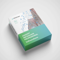
Full control and best photogrammetry results? Check out Agisoft Metashape now!
Increase profits and yields with Agriculture 4.0? Optimise your cultivation with Pix4Dfields !
- SKU:
- AC25974
- Variations in:
-
- Licence length
- Number of devices
Highlights
- user-friendly
- high-quality 3D models
- fast, precise orthomosaics
Suitable for
- Beginners & advanced users in photogrammetry
- Drone service providers & construction companies
- Agricultural, property & architecture industry
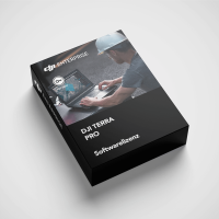
- Owners of a DJI laser scanner (e.g. L1, L2)
- SKU:
- AC26089
- Variations in:
-
- Licence type
Highlights
- Photogrammetric 3D reconstruction
- Support for LIDAR and multispectral data
- Machine learning techniques
Suitable for
- Architects and civil engineers
- Farmers and agricultural specialists
- Cartographers and geodesists
- Environmental scientists
- SKU:
- AC26133
- Variations in:
-
- Licence
- SKU:
- AC26134
- Variations in:
-
- Licence
- Subscription type
- SKU:
- AC26135
- Variations in:
-
- Licence
Pix4Dfields - the mapping software for agriculture!
- SKU:
- AC26143
- Variations in:
-
- Subscription type
- SKU:
- AC26144
- Variations in:
-
- Licence
- SKU:
- AC27013
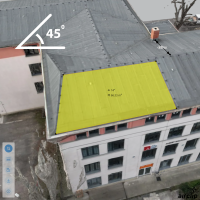
Highlights
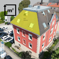
- simple operation including measuring tools
- 3D model in the web viewer
- Import into common planning software
- from as little as €50 per project
Suitable for
- PV planners
- PV installers
- Solar engineers
- Scaffolders
- SKU:
- AC27138
- Variations in:
-
- Number
- SKU:
- AC27140
- Variations in:
-
- Version
- SKU:
- AC27294
Highlights
- simple operation including measuring tools
- 3D model in web viewer
- from just €25 per project
Suitable for
- Carpenters and roofers
- Tinsmiths (plumbers)
- Surveyors
- Facility management
Surveying software for drones
Here you will find carefully selected software solutions from leading manufacturers that have been specially developed for use with drones. Our products offer you the latest technologies to take your surveying, mapping and analysis projects to the next level.
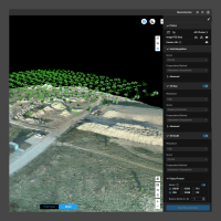
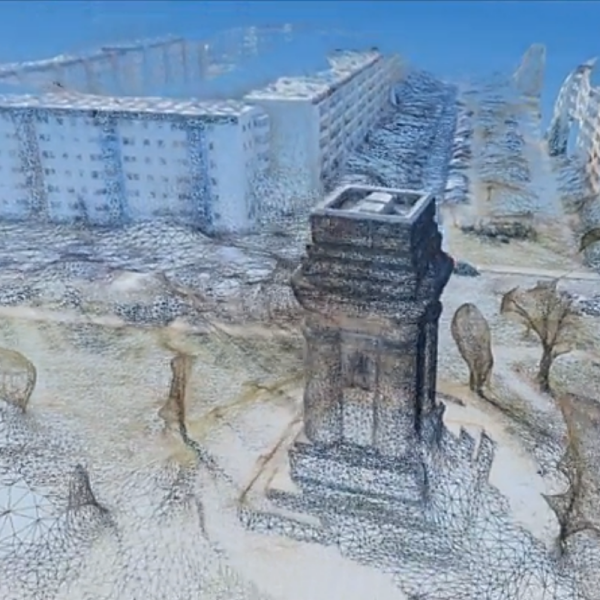
Photogrammetry is a revolutionary technique that uses photography to create precise measurements and models. Drones can be used to survey large areas quickly and safely , significantly increasing efficiency and accuracy compared to traditional methods. Our photogrammetry software processes the captured images and uses them to create high-resolution 3D models, orthophotos and topographical maps.
Our software solutions are characterised by maximum precision. They utilise advanced image processing algorithms to ensure extremely accurate models and measurements. By using drones, large areas can be covered in the shortest possible time, drastically reducing the cost and time required for traditional surveying methods. The user-friendliness of our software also enables users without in-depth technical knowledge to use it easily and obtain results quickly.
Core functions and application
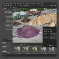
The core functions of our software include automatic image processing, which processes captured images into detailed 3D models and maps . You can create dense point clouds that can be used for precise analysis and visualisation. The creation of seamless, georeferenced orthophotos enables accurate mapping. In addition, the software provides accurate volume calculations, ideal for material removal and stockpiles. Another important feature is progress monitoring, which allows you to track the progress of your construction projects through regular aerial photography and 3D modelling.
Our photogrammetry software is used in many areas:
- Construction: Surveying construction sites, monitoring construction progress, capturing terrain profiles.
- Agriculture: precision farming, analysing plant growth, predicting yields.
- Environmental monitoring: documentation of changes in the landscape, monitoring of protected areas, recording of environmental disasters.
- Disaster prevention: Rapid mapping of damaged areas, support for rescue operations, planning of reconstruction measures.
Why buy software from Airclip?
The photogrammetry software we offer provides you with the highest accuracy and reliability for your surveying and mapping projects. Thanks to the intuitive user interface and automated processes , the software is easy to use even for users without in-depth technical knowledge. By using drones and our software, you save valuable time and reduce your costs compared to traditional surveying methods. Our software offers flexible solutions for a wide range of applications.
If youhave any questions or would like personalised advice , our sales team will be happy to help. We support you in selecting the right software and offer comprehensive training and support so that you can utilise the full potential of your photogrammetry software. Discover our selection of photogrammetry software for drones now and revolutionise your data acquisition and analysis. Order conveniently online and benefit from our fast shipping and excellent customer service.
